The first sign that something unusual was happening, Tom Lawrence said, wasn’t on a screen. It was in his lungs.
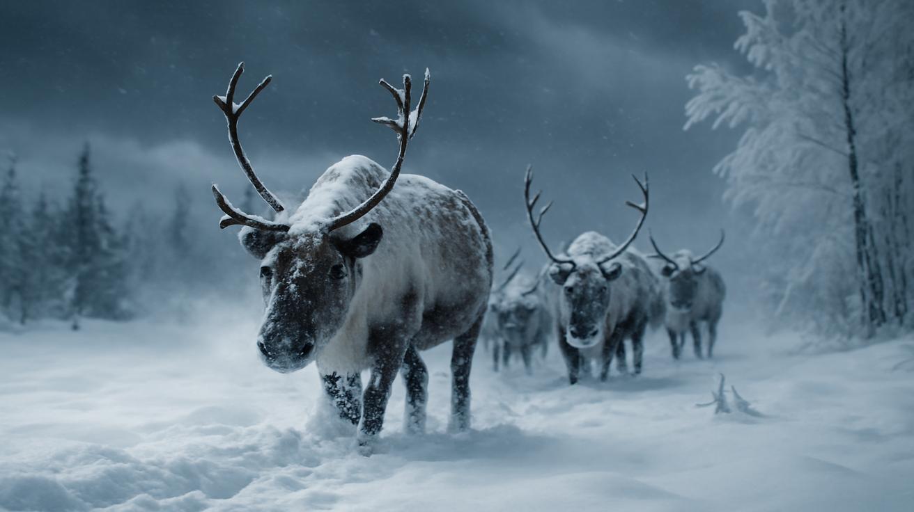
“The air felt wrong,” he told me, standing in a frost-bitten field somewhere in northern Finland, where the sky had settled into that blue-gray color that looks almost metallic. “Too still. Too sharp. Like the cold had suddenly remembered an old trick.”
Tom is an atmospheric scientist who has spent the last fifteen winters chasing a ghost most of us never see: the invisible turmoil more than 30 kilometers above our heads, in the thin, frigid stratosphere. Down here, winter is about frozen windshields, wool hats, and shoveling driveways. Up there, winter is a different creature entirely—a place where temperatures can plunge below -80°C, winds scream around the pole at over 300 kilometers per hour, and the stability of that high-altitude vortex can quietly determine whether your city gets a mild drizzle or a paralyzing blizzard.
This winter, that ghost finally stumbled. And the numbers coming out of labs and observatories across the Northern Hemisphere are making even veteran researchers pause, then check their instruments again, and again.
Listening to the Sky’s Spine
“Think of the stratospheric polar vortex as the spine of the winter atmosphere,” explained Dr. Meera Anand, who oversees a network of weather balloons that rise past commercial flight paths into the thin air between the troposphere and space. “When that spine is straight and strong, the weather below behaves in fairly predictable ways. When it kinks, or snaps, everything attached to it starts moving strangely.”
The vortex is a swirling ring of strong westerly winds that circles the Arctic each winter. It forms naturally as the polar regions plunge into darkness, trapping cold air high above the pole like water spinning in a giant cosmic drain. Most winters, it holds itself together, wobbling, stretching, occasionally weakening—but still recognizably intact.
This season, the instruments started whispering a different story. Temperature readings at key stratospheric levels began climbing fast—10, 20, then 30 degrees Celsius warmer than average in certain pockets of the upper atmosphere. Wind speeds, usually a roaring jet around the pole, dipped and twisted, as if someone had pressed fingers into the spinning ring and dragged it out of shape.
“We watch certain thresholds that tell us whether what we’re seeing is routine variability or something more serious,” Meera said. “By late January, we’d crossed into a territory we’ve only seen a handful of times since we started keeping records.” She paused, letting the weight of that statement sink in. “And the readings kept going.”
The Quiet Drama Above the Clouds
From the ground, the drama is invisible. There are no sudden green flashes, no unnatural colors painted across the sky—just the usual cottony drift of cloud and perhaps, if you’re far enough north, a curtain of aurora threading the horizon. Yet, tucked into satellite channels and balloon soundings, the atmosphere’s upper layers were contorting like a slow-motion gymnastics routine.
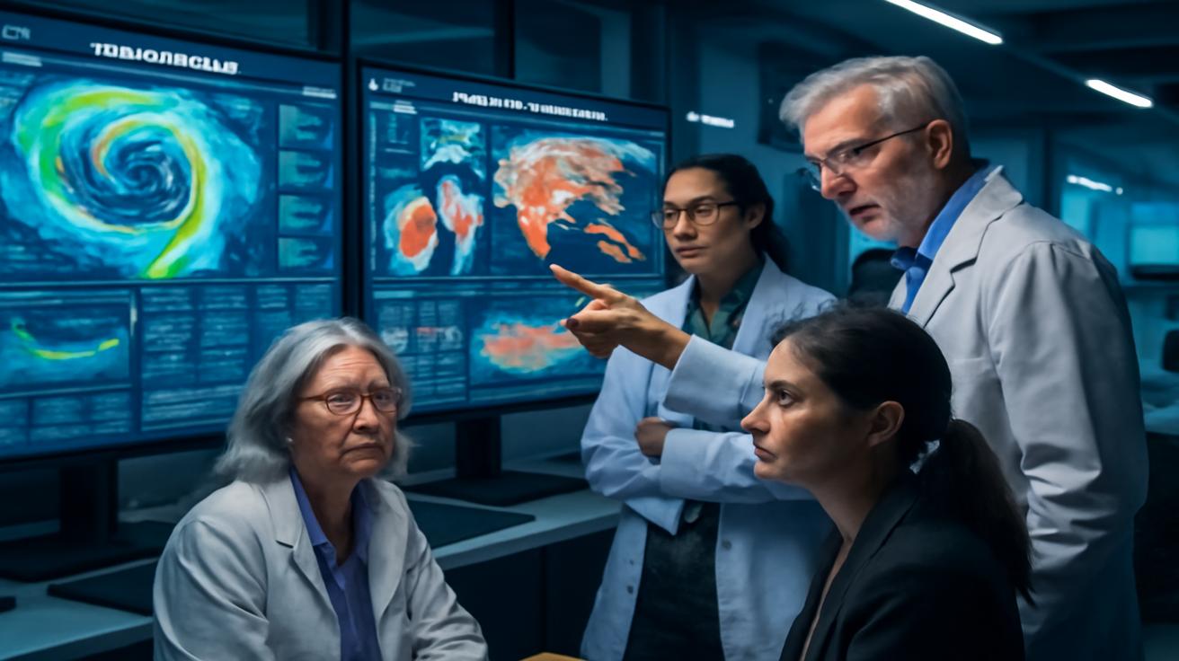
In a lab in Berlin, a researcher named Kai leaned close to his monitor as a temperature cross-section arrived from a weather model that blends satellite, balloon, and aircraft data. A smudge of deep red—warm anomaly—bloomed right above the polar cap, like a wound in the frozen sky.
“There it is,” he said, half to himself, half to the team gathered behind him. “The split is starting.”
They watched in near silence as time-lapse model runs showed the once-coherent vortex unraveling. Instead of one robust, cold-centered whirl over the Arctic, the vortex elongated, fractured, and began dividing into separate lobes, migrating away from the pole toward lower latitudes.
This is the kind of thing you read about in technical reports under precise names: stratospheric warming, vortex displacement, vortex split. In the language of people who live closer to the ground, it means that the high-altitude gatekeepers maintaining the usual separation between the deep polar cold and the milder mid-latitudes were starting to malfunction.
Only a Few Winters Like This
When researchers say the current readings line up with only a few extreme winters in recorded history, they’re not being poetic. They are literally scrolling back through decades of data and finding only a small handful of years when the numbers have looked like this.
In a dim control room lit mostly by blue monitors, a climatologist named Sienna brought up a comparison chart of stratospheric temperatures, wind speeds, and pressure patterns going back to the mid-20th century.
“You see this?” she said, tracing a finger along a jagged line that suddenly spiked. “That’s this winter. And the only winters that come close are 2009–2010, 2012–2013, and a few much older ones further back. Depending on which parameter you look at—wind reversal, temperature change, timing—you’re really only talking about a handful of analogs.”
The rarity is what makes everyone lean in a little closer. Extreme events in the stratosphere—especially sudden stratospheric warmings that disrupt or even reverse the vortex winds—are like throwing a rock into a still pond. The splash happens up high, but the ripples spread downward over days and weeks, eventually disturbing the weather patterns we experience at the surface.
“Not every extreme stratospheric event leads to a memorable winter for people on the ground,” Sienna cautioned. “But a striking number of the really notorious winters—blocked patterns, prolonged cold snaps, staggering snowfalls—have this kind of disturbance sitting above them in the data.”
Cold Memories, Warm Anomalies
For older meteorologists, this winter’s upper-air charts stir a kind of uneasy déjà vu. They remember the headlines, the frozen fountains in city squares, the satellite images of continent-wide snow cover, the way entire regions seemed to hunker down for weeks at a time.
“Look at the historical twins,” said Tom, now back inside a temporary field station where a heater hummed against the dark Arctic afternoon. On his laptop, colorful maps shimmered: stratospheric anomalies on top, surface weather patterns below. “You see this pairing again and again—intense warming high above the pole followed by, say, a blocking high pressure zone forming over Greenland, or Siberian air spilling southward in these long, stubborn tongues.”
The current readings—temperatures far above normal in the polar stratosphere, winds slowing and in some regions reversing direction, the vortex elongating and splitting—fit right into that family portrait of rare, consequential winters.
Yet one detail makes this winter’s readings stand out even more: the backdrop of an already transformed climate system. Global average temperatures at the surface are warmer, sea ice coverage is different, and the configuration of the jet stream carries its own new quirks.
“It’s like watching an old play being performed on a slightly tilted stage,” Meera said. “We have some sense of the script from the past, but the set has changed.”
How a Broken Vortex Touches Your Street
All of this might sound remote—a drama unfolding somewhere between the cruising altitude of a jet and the edge of space. But the way stratospheric instability filters downward can eventually be felt in the most mundane details of daily life.
A week or two after the initial disruption, pressure patterns in the troposphere—the thick lower layer where our weather actually happens—start to shift. Highs stall where they don’t usually stall. Storm tracks sag or veer. The well-behaved river of the polar jet stream buckles into exaggerated loops.
On maps, it looks almost elegant—these sweeping arcs funneling air masses across oceans and continents. On the ground, it can mean your city swings from damp gray to sudden, biting cold; that rain briefly becomes searing lake-effect snow; that waves smash more angrily into coasts as storms crawl instead of race past.
Scientists are careful with predictions, but they do talk about probabilities. When the vortex is intact and strong, harsh cold air tends to stay bottled near the pole. When it weakens or breaks, that cold is more free to spill out and mix, sometimes pooling over Europe, sometimes over North America, sometimes over Asia.
To make the connections clearer, Kai pulled up something simple: a small table summarizing how some of the most prominent extreme winters have stacked up against key stratospheric indicators.
| Winter Season | Stratospheric Signal | Vortex Behavior | Surface Impacts (Overview) |
|---|---|---|---|
| 2009–2010 | Strong warming, large wind reversal | Vortex split and displaced | Severe cold in Europe, major snow in parts of N. America |
| 2012–2013 | Significant mid-winter warming | Vortex distorted, weakened | Persistent cold snaps, prolonged snow cover in Eurasia |
| Current Winter | Anomalies matching rare historic extremes | Rapid weakening, signs of split/displacement | Still unfolding; elevated risk of regional cold outbreaks and blocking |
“It’s not a guarantee,” Kai emphasized, tapping the last row. “But when our current winter starts showing up in the same neighborhood as these others, we pay very close attention.”
The People Under the Pattern
Somewhere far from the glowing labs and field stations, a bus driver in Montreal wipes fresh snow off his windshield for the third time in a week. A farmer in Poland checks a ten-day forecast, then another, trying to guess whether a brutal cold snap will threaten her winter wheat. A city planner in Tokyo updates contingency plans for unusually heavy snowfall that might or might not come.
What happens high above them is translated into probability charts, color-coded maps, and light-blue bars on energy demand forecasts. The language shifts from “sudden stratospheric warming” to “enhanced risk of prolonged cold conditions” or “increased chance of blocking patterns that may lead to persistent weather anomalies.”
In other words: keep the snowplows ready; check on your heating systems; prepare, but don’t panic.
Meanwhile, in Arctic towns where the nights are still long, people notice more immediate, tactile details. The way the snow squeaks differently under boots when the temperature drops sharply. The subtle change in the sound of wind around the corners of old wooden houses. The crispness of stars overhead when the air dries out in advance of a deep cold spell spilling south.
Watching a Rare Dance in a Warming World
One of the strangest tensions of our time is that we are living on a warming planet that can still deliver episodes of furious, bone-deep cold. To some, that sounds contradictory. To atmospheric scientists, it’s entirely consistent with what a complex, changing climate can do.
“There’s this misconception that global warming means the end of cold winters,” Sienna said, leaning back in her chair. “But what it really means is a shift in distributions—a nudge to the odds. The baseline is warmer, yes, but the way energy and moisture move around the system can actually make certain kinds of extremes more likely in some regions.”
Stratospheric instability is one of the ways that subtle shifts high above our heads can result in very unsubtle days on our streets. Add a warmer ocean here, less sea ice there, slightly altered storm tracks, and the familiar patterns of the past begin to morph into something not quite like anything in the records.
“When we say the current readings align with only a handful of extreme winter events in recorded history, we’re really saying two things,” Meera added. “First, this kind of stratospheric disruption is rare enough to deserve attention. Second, we’re now seeing that rare pattern against the backdrop of a climate that’s warmer and more energized overall. That combination is new.”
It’s like watching a dancer you’ve seen before suddenly perform on a swaying stage with a different soundtrack. The moves are familiar, but the outcome feels less predictable.
Listening, Not Just Predicting
Back in that Finnish field, where the sun barely cleared the horizon before sliding sideways into twilight, Tom tightened the strap on his parka and looked up. Somewhere above, beyond the invisible ceiling of the troposphere, the warped vortex was still tumbling and rearranging itself, sending slow signals downward.
“We have these incredible models now,” he said, breath turning to a soft cloud in the freezing air. “We can track the vortex, compare it to historic events, estimate the likely impacts. But what I never want to lose is the sense that we’re also just…listening.”
Listening to the subtle way an upper-air wind profile bends. Listening to how the atmosphere remembers last season’s heat wave, or last year’s lack of sea ice, and reshapes its currents in response. Listening to the fact that, every so often, the spine of winter above our heads flexes in a way it almost never has before.
For all the graphs and equations, there is a quiet humility in that listening. It acknowledges that we are living inside a system we don’t fully understand, one that has its own rhythms and thresholds and tipping points. A system that can, in a matter of weeks, turn an abstract anomaly 30 kilometers above the Arctic into the crunch of ice under your morning boots.
As this winter continues to unfold, the researchers tracking stratospheric instability will keep reporting what they see: temperature spikes, wind reversals, pressure oddities—and the eerie familiarity of charts that line up with only a few winters etched deeply into meteorological memory.
For the rest of us, the job may be simpler: to pay attention. To notice how interconnected it all is—the warmth of an ocean, the curvature of a jet stream, the way your city feels when an unfamiliar cold settles in and doesn’t quite want to leave.
Somewhere, above the smog and the contrails and the tallest clouds, the winter sky is shifting its weight from one foot to the other, rehearsing a rare dance. And down here, shivering on sidewalks and staring at forecasts, we are part of the choreography whether we realize it or not.
Frequently Asked Questions
What is stratospheric instability?
Stratospheric instability refers to unusual or extreme changes in the stratosphere’s normal patterns—especially temperature, wind speed, and circulation around the poles. When those changes are strong enough, they can disrupt the polar vortex and eventually influence weather patterns closer to the ground.
What is the polar vortex, really?
The polar vortex is a large-scale, ring-like circulation of strong westerly winds in the stratosphere that forms over the poles in winter. It helps keep very cold air locked near the Arctic. When the vortex is strong and stable, cold air tends to stay bottled up; when it weakens or splits, that cold can spill south into mid-latitudes.
How can something so high up affect my local weather?
Disturbances in the stratosphere gradually propagate downward, altering pressure patterns in the troposphere, where everyday weather happens. This can reshape the jet stream, change storm tracks, and create “blocking” patterns that lock regions into prolonged cold, warmth, or wet conditions.
Does stratospheric instability prove or disprove climate change?
Neither. Stratospheric instability is a natural part of the climate system, but its frequency, intensity, and impacts can be influenced by long-term warming and changes in sea ice, snow cover, and ocean temperatures. Researchers study these events to better understand how a warming climate may be altering the odds and character of extreme winters.
Should I expect a severe winter if the polar vortex is disrupted?
Not automatically. A disrupted vortex increases the chance of severe or prolonged cold in some regions, but it doesn’t guarantee it. Where the cold ends up depends on how the jet stream and pressure patterns respond, which can favor different continents in different years. It’s a heightened risk, not a promise.
Can these events be predicted in advance?
Scientists can often see signs of a developing stratospheric disruption one to several weeks ahead, especially with modern satellite data and models. Translating that into precise local weather impacts is harder, but it does allow forecasters to talk about elevated risks of certain patterns well before they fully develop.
Are such extreme readings becoming more common?
The historical record is still relatively short, and the picture is complex. Some studies suggest that certain types of polar vortex disruptions and related jet stream patterns may be changing as the climate warms, but there is still active debate and research. What is clear is that when such rare events do occur, they now unfold in a climate that is warmer overall than it used to be, which can alter their impacts.


Leave a Comment