
The warning doesn’t arrive with sirens or breaking-news banners. It comes in the careful, measured voices of scientists peering at swirls of color on polar maps—a strange blossom of pressure lines and wind fields that, to them, feels louder than any alarm. In the quiet, blue darkness that still blankets much of the Arctic before March, something is tightening, twisting. Meteorologists call it “atmospheric stress.” To those watching closely, it looks like the Arctic is holding its breath.
The Arctic’s Quiet Tension
High above the ice and snow, tens of thousands of feet in the air, the polar atmosphere is humming with imbalance. Meteorologists, squinting at reanalysis charts and satellite data, describe it with language that sounds almost human: a jet stream that looks “tired,” a polar vortex that seems “stretched,” pressure systems “battling” for dominance. These are metaphors, sure—but they are also hints that something is markedly off.
Normally, late winter in the Arctic has a kind of grim consistency. Strong, cold air pools over the pole, locked in place by a robust polar vortex—a spinning crown of frigid wind that keeps Arctic air mostly contained. Around this structure, the jet stream kinks and curves but generally flows in a predictable band. By February, the system is usually stable, even if it is brutally cold.
This year, meteorologists warn, that stability is fraying.
Pressure patterns in the upper atmosphere are shifting more intensely and more erratically. Heat is surging upward from lower latitudes and from the ocean surface, while sea ice extent sits below long-term averages. All of this piles “stress” onto the finely tuned atmospheric engine that spins above the Arctic. To an untrained eye, the maps may look beautiful—bands of red and blue sweeping around the northern hemisphere. To those who study them, they suggest an atmosphere nearing a breaking point.
“We’re seeing the stress peak just before March,” one researcher observes in a recent briefing. Translation: the coming weeks, as winter leans toward spring, are a particularly delicate period when disruptions can echo far beyond the circle of ice and snow.
The Pulse of Polar Air
If you want to understand why forecasters are nervous, you have to zoom out—or, more accurately, zoom up. Picture the atmosphere like a layered, spinning shell around the planet. In the lower layers, where we live and breathe and complain about the weather, cold fronts and warm fronts tussle daily. But in the stratosphere, higher up, lies the polar vortex: a massive ring of cold air swirling around the Arctic like a ghostly hurricane.
When the vortex is strong and circular, the Arctic air is largely corralled. Surface weather in mid-latitudes may still bring storms and cold snaps, but it tends to follow familiar patterns. When that vortex weakens, stretches, or splits, the trouble begins. Lobes of cold air can plunge south, while warm air surges north—upsetting the usual choreography of the seasons.
This winter, meteorologists have watched waves of energy—called planetary waves—propagate upward from the lower atmosphere into the stratosphere. These waves are stirred by mountains, land–sea contrasts, and large weather systems. When they crash into the polar vortex, they can disturb it, even flip it inside out in a phenomenon known as a sudden stratospheric warming.
What’s different now is the intensity and frequency of these stress events. Ocean temperatures have been abnormally high. Sea ice has been abnormally low. And the temperature gradient between the Arctic and the mid-latitudes—the difference that helps drive winds and the jet stream—has been subtly but relentlessly eroded by decades of warming. The atmosphere is, in a real sense, less tightly wound than it used to be, more prone to wild lurches and stumbles.
To meteorologists, the Arctic is like a pulse point on the planet’s body. Now, just before March—a month when the polar night begins to break and sunlight returns—the pulse is irregular, jumpy, stressed. The timing matters. This is when the polar vortex typically starts to weaken in a controlled, seasonal way. An extra shove from below, at just the wrong moment, can turn a graceful unwinding into a messy collapse.
When the Arctic Sneezes, We Shiver
The phrase “Arctic atmospheric stress” might sound remote, like something that belongs only in academic papers. But what happens over the Arctic doesn’t stay there. The winds and pressure patterns that shift at the top of the world tug on the weather thousands of kilometers away, like invisible threads stitched into the jet stream.
Picture the jet stream as a high-altitude river of air, fast-flowing and wavy, snaking across continents. Its meanders decide whether winter storms slam into one region or veer harmlessly out to sea; whether frigid polar air pours down over cities or stays locked in the far north; whether one place soaks under unrelenting rain while another languishes under blank blue skies.
When the Arctic is under stress—when the polar vortex is disturbed, when the pressure fields buckle—the jet stream can become more contorted. Large ridges of high pressure can form and linger, blocking systems and holding weather patterns in place far longer than usual. Deep troughs of low pressure can dig southward, dragging cold air with them and fueling heavy snow, ice storms, or soaking rains.
In recent years, people in North America and Europe have felt this in their bones. One winter brings a “polar vortex” outbreak, plunging temperatures well below normal. Another brings a strangely mild season punctuated by sudden, brutal cold snaps. Storms that might once have skimmed over the Atlantic now slam into coastlines with more intensity. Droughts and floods, heat spikes and freeze events—they all trace part of their story back to the shape and strength of the polar vortex and jet stream.
Meteorologists watching the Arctic stress peak before March know this chain reaction all too well. A perturbed polar vortex in late winter can mean late-season snow in places already dreaming of spring, or unusually persistent storms that slow the thaw of rivers and ground. It can also mean pockets of early warmth that jolt ecosystems awake before they’re ready, then slam them back into cold, damaging bud and bloom.
It’s not that every twist in the Arctic atmosphere guarantees a dramatic event where you live. The planet’s climate is too complex, too noisy, for such clear cause-and-effect. But the odds shift. The deck of possible weather outcomes is reshuffled. And right now, the people whose job is to read those cards are seeing more wild ones appear.
Signals Written in Ice, Wind, and Light
On a calm day in late winter, Arctic weather can feel deceptively simple: crystalline air, the soft hiss of snow under a sled, the low sun barely nudging above the horizon. Yet even here, the signs of atmospheric stress write themselves into the landscape for anyone who knows how to look.
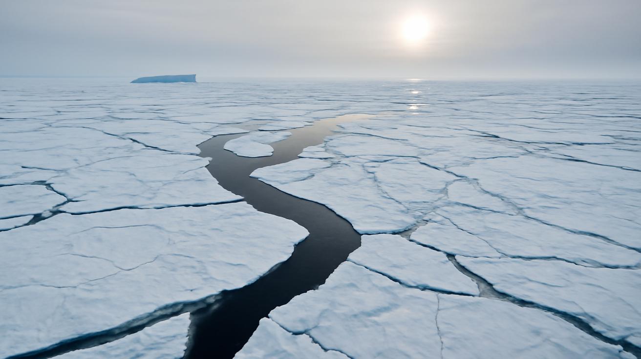
Sea ice, for one, has become thinner, more fractured, more transient. The old, multi-year ice that once gave the polar ocean a kind of backbone is scarcer. In its place: younger, more fragile ice that forms later in the season and melts sooner. When winter storms churn across this weaker ice cover, they push heat and moisture into the air more efficiently, feeding back into the atmosphere’s restless energy.
Temperature inversions—where warmer air sits above colder surface air—have become stranger too. In some Arctic regions, meteorologists measure shallow inversions punctured by sudden warm spikes, as if the sky itself were exhaling bursts of unexpected heat. These spikes can ripple upward, disturbing higher layers of the atmosphere, again adding to that complex web of stress.
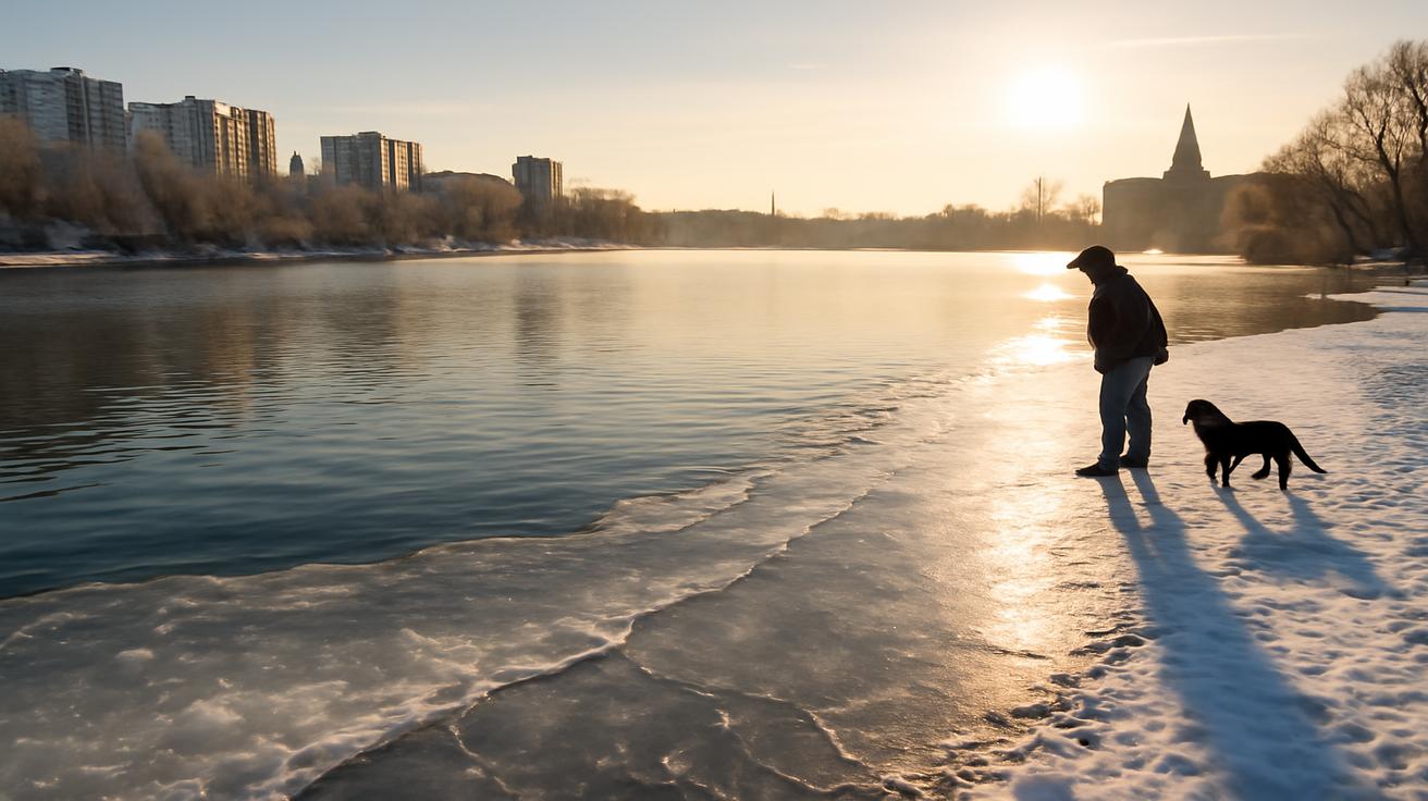
To communities living in the Arctic, the changes are not abstract charts but real shifts in daily life. Hunters find that trails once reliable are now interrupted by newly opened leads of dark water. Storms arrive from different directions, with unfamiliar timing. Winds carve new patterns in snowdrifts, confusing those who navigate by long-learned cues. Over time, people adapt, but the learning curve grows steeper with each decade of change.
Even the light feels different. As March approaches, the Arctic transitions from the long polar night toward a brighter season. Yet the timing and intensity of storms can smear that transition—weeks of cloud cover dimming the increasing sun, or sudden clear stretches exposing bare, snowless ground that should still be locked in white. These visual shifts are subtle, but to those who’ve watched many winters pass, they whisper of a system out of balance.
Reading the Data Behind the Drama
Behind every poetic description of an unsteady Arctic lies a backbone of numbers: pressure anomalies, temperature departures, wind speed gradients. Meteorologists pore over these, building a kind of narrative out of pixels and equations. The phrase “atmospheric stress” is a bridge between that data-heavy world and the one the rest of us inhabit.
To understand what they’re seeing, it helps to glance at a simplified snapshot. Below is a compact, mobile-friendly table that summarizes some of the key indicators scientists track during late winter in the Arctic—indicators now pushing into worrying territory.
| Indicator | Typical Late Winter Pattern | Current/Recent Trend | Implication |
|---|---|---|---|
| Polar Vortex Strength | Strong, relatively stable, centered near the pole | More frequent weakening & displacement events | Greater risk of cold air outbreaks and erratic winter weather |
| Jet Stream Shape | Moderately wavy, zonal west-to-east flow | More amplified ridges & troughs, slower-moving patterns | Blocking highs, prolonged storms or dry spells |
| Arctic Sea Ice Extent | Large, thick pack ice near seasonal maximum | Below average extent, thinner & more fractured ice | More heat & moisture flux into the atmosphere |
| Surface Temperature Anomalies | Intense cold confined near the pole | Arctic warming faster than global average | Weaker temperature gradient, altered wind patterns |
| Planetary Wave Activity | Moderate upward flux, seasonal variability | More frequent strong wave pulses | Increased stress on the stratospheric polar vortex |
None of these indicators alone tell the whole story. But together, they sketch the outline of a system nudged away from its long-term norms. A slightly weaker temperature gradient here, a little less sea ice there, plus an ocean that has quietly retained too much heat over summer and autumn—and suddenly the winter atmosphere becomes a more volatile, less predictable place.
Meteorologists use ensembles of models—running the atmosphere forward dozens of times with small variations—to gauge what might happen next. In many of those scenarios, late-winter Arctic stress leads to more pronounced jet stream distortions as March approaches, with ripple effects on storm tracks from the Pacific to the Atlantic. That doesn’t mean disaster is guaranteed. It means the dice tilt toward more unusual configurations, more “I’ve never seen it do that before” moments on the weather map.
Living With a Tense Sky
For most of us, the sky’s tension reveals itself only when it finally breaks: a late blizzard, a dangerous ice storm, a winter heat wave that melts snow in a single weekend. But for those whose livelihoods depend on subtle cues—farmers, fishers, Arctic communities, emergency planners—the stress building over the Arctic is a practical concern.
Consider agriculture. A cold plunge triggered by a distorted jet stream in late March can devastate budding fruit trees or swelling winter wheat. A stalled storm system can soak already saturated fields, delaying planting. An early warm spell followed by a deep freeze can undo weeks of growth. The link back to the Arctic might seem distant, but it’s real, braided through the jet stream’s wandering path.
Or consider city infrastructure. Utilities brace for energy spikes whenever forecasters flag a potential polar air outbreak. Road crews prepare for rapid freeze–thaw cycles that shatter pavement. Coastal towns eye storm tracks that suddenly pivot, turning what was supposed to be a glancing blow into a direct hit.
What meteorologists are warning, in essence, is that the ceiling above all these plans and systems is more fragile than it used to be. The Arctic’s atmospheric stress is peaking just before March, at a time when many regions are shifting mentally toward spring, easing winter precautions, and planning for the next season. It’s exactly the moment when an unstable pattern can catch people off guard.
None of this is cause for panic, but it is a plea for respect—for the complexity of the atmosphere, for the cascading influence of a warming Arctic, and for the value of listening to those who watch the data day after day. When scientists say the Arctic is under stress, they are not anthropomorphizing the sky. They are translating the language of numbers into something we can feel.
Looking Up, Looking Ahead
So what do we do with this knowledge—that the Arctic atmosphere is strained, that its stress is nearing a seasonal peak just as March waits on the calendar’s next page?
On a personal level, it can mean something as simple as paying closer attention. Not just to the forecast on our phones, but to the changing rhythms around us: the timing of birds returning, the date the snow reliably leaves the hills, the way storms seem to linger or arrive in new patterns. Those small observations, repeated across millions of lives, form the ground truth that either confirms or challenges what the models suggest.
On a collective level, it reinforces what climate scientists have been saying for years: that a rapidly warming Arctic does not just raise sea levels and melt icebergs, but rewires weather patterns far beyond its borders. As greenhouse gases accumulate, the Arctic warms faster than the rest of the globe—an effect called Arctic amplification. That uneven warming destabilizes long-standing atmospheric structures. The polar vortex and jet stream, once relatively rigid guardrails of the seasons, begin to wobble.
We are living through the early chapters of that rewiring. The fact that meteorologists now speak openly about “Arctic atmospheric stress” peaking in late winter is a sign of how normal it has become for the far north to behave in surprising ways. What used to be rare, headline-worthy events—a split vortex, a sudden stratospheric warming—are now frequent enough to feel like familiar characters in the seasonal drama.
Yet there is still wonder alongside the worry. To understand the atmosphere is to be perpetually humbled by it: the way a slight shift in sea-surface temperature reverberates through clouds and winds across an entire hemisphere; the way the returning spring sun in the Arctic gently unthreads the polar night, nudging the vortex to relax; the way small islands of high pressure can redirect storms like pebbles diverting a river.
If you find yourself stepping outside on a late-winter evening in the coming weeks, look up. The sky may look placid, stars glittering, a moon riding quietly along its path. But above that stillness, the atmosphere is in motion—stretched, strained, seeking balance. Far to the north, over ice and ocean and cold, dark water, the Arctic is working through its tension, passing it, piece by piece, into the currents that shape the weather you will wake up to tomorrow.
The meteorologists, still at their screens, still comparing model runs to real-world observations, will be watching. The maps will tell them when the stress has begun to ease, when the polar vortex has decided its fate for the season, when March has fully taken winter’s hand.
Until then, the warning stands: the Arctic atmosphere is under peak stress. And when the top of the world holds its breath, the rest of us, whether we realize it or not, are breathing with it.
Frequently Asked Questions
What does “Arctic atmospheric stress” actually mean?
It refers to a combination of unusual conditions in the Arctic atmosphere—such as disturbed pressure patterns, a weakened or distorted polar vortex, and amplified planetary waves—that together indicate the system is under strain and behaving less predictably than usual.
Why is this stress peaking just before March?
Late winter is when the polar vortex naturally begins to weaken as sunlight slowly returns to the Arctic. At this vulnerable stage, extra heat from the ocean, reduced sea ice, and strong wave activity from lower latitudes can more easily disrupt the vortex, causing stress to peak just before the seasonal transition into spring.
How can this affect weather where I live?
Disturbances in the Arctic can alter the shape and speed of the jet stream, which guides storm tracks. That can lead to late-season cold snaps, prolonged storms, unusual warm spells, or blocking patterns that lock in certain weather—like heavy rain or dry conditions—for longer than normal.
Is this all because of climate change?
Human-caused climate change is a major driver because it warms the Arctic faster than the global average, reduces sea ice, and stores more heat in the oceans. These changes modify the temperature contrast and energy flows that shape the polar vortex and jet stream. Natural variability still plays a role, but it is now unfolding on top of a shifted baseline.
Should we expect winters to become more extreme or milder overall?
Both can be true. On average, winters are warming, with fewer extremely cold days. At the same time, a more unstable Arctic atmosphere can increase the likelihood of occasional, intense cold outbreaks or disruptive storms. The background climate is milder, but the weather can still swing sharply from one extreme to another.
Can meteorologists predict these Arctic stress events well in advance?
They can often see signs of developing stress a few weeks ahead, especially when strong planetary waves are forecast to disturb the stratosphere. However, the exact timing and regional impacts—like where a cold outbreak will hit hardest—remain challenging to pinpoint more than 10–14 days in advance.
What can communities do to prepare for these shifting patterns?
Preparation includes closely monitoring seasonal outlooks, investing in resilient infrastructure, planning for both unusual cold and unseasonal warmth, and incorporating climate projections into long-term decisions for agriculture, water management, and emergency response. Staying informed about Arctic-driven pattern changes helps avoid being caught off guard by late-winter surprises.


Leave a Comment