
The news slipped in quietly, the way winter often does—just a line in a forecast, a technical phrase on a weather map: “polar vortex disruption.” It sounds remote, abstract, like the atmosphere’s private business far above our heads. Yet what’s brewing miles above the Arctic this season may soon be knocking on our doors as ice-glazed sidewalks, sideways snow, and a cold that feels like it has a personal grudge. This isn’t just another chilly spell. This is the story of how a swirling ring of icy air at the top of the world can falter, split, and tumble the weather into chaos thousands of miles away.
The Quiet Above: Where the Polar Vortex Lives
High above the everyday weather—the clouds you watch, the rain you complain about, the snow you shovel—there is a hidden engine. Imagine a colossal, invisible whirlpool of frigid air encircling the Arctic, spinning in the stratosphere about 10 to 30 miles above the ground. That’s the polar vortex. When it’s strong, it’s like a well-locked freezer door, keeping the most bitter Arctic air sealed tightly over the pole.
Most winters, we never think about it. Jet streams ripple, storms roll through, and life follows a pattern we’ve come to expect: cold fronts, warm-ups, maybe a snowstorm or two. But the polar vortex hums along above all of that, mostly stable, mostly predictable—until it isn’t.
A polar vortex disruption is like someone leaning against that freezer door. Suddenly it shudders, buckles, and in some cases, cracks open. The air inside—the kind that gnaws at fingertips and creeps through the seams of every window—spills south. Once that door is ajar, the whole balance of winter can tip.
When the Sky Warms and the Vortex Breaks
Counterintuitive as it sounds, the drama often begins with warmth—just not where you live. Far above the Arctic, waves of energy can surge upward from the lower atmosphere, piling into the stratosphere. This process, known as a sudden stratospheric warming event, can raise temperatures there by tens of degrees in only a few days.
Picture the polar vortex as a spinning top on a table. It’s stable when it’s fast and centered. Now imagine someone flicking the table from underneath. The top wobbles, slows, maybe even splits into two smaller tops drifting away from the center. That’s what can happen when the stratosphere warms dramatically: the orderly ring of cold air starts to deform, weaken, or fracture.
Some years, the vortex simply stretches, sagging toward North America or Eurasia. Other times it tears apart, sending two or more lobes of polar air careening into mid-latitudes. On weather maps, you see it as a bizarre, meandering cold pool pushing deep into areas that usually sit well outside the Arctic’s grip. On the ground, you feel it as a piercing cold that refuses to leave.
The Long, Slow Domino Effect
What happens up there doesn’t stay up there. Over days to weeks, the disrupted vortex starts to tug at the jet stream, the high-altitude river of fast-moving winds that steers storms around the globe. Instead of flowing smoothly from west to east, the jet stream buckles into great, looping waves.
Where it bends north, mild air surges far into higher latitudes, nudging winter aside. Where it plunges south, Arctic air pours in like a tidal wave. These contortions can stall, locking regions into extended patterns: relentless cold, grinding snowstorms, or icy, freezing rain that just keeps coming.
By the time you’re scraping a half-inch of ice off your windshield or watching snow bury your street for the third time in a month, the original drama in the stratosphere is long over. Yet its fingerprints are everywhere—in the sudden flip from tame winter to something raw, loud, and dangerous.
From Sky to Street: How Disruption Turns into Hazards
To most of us, the science behind the polar vortex matters less than what it means for our daily lives. A large disruption doesn’t automatically mean a historic cold wave for everyone, but it dramatically raises the odds of extreme and prolonged winter weather across wide regions.
Depending on where you live, the fallout can take different forms:
- Prolonged deep freezes that push heating systems to their limits and transform simple errands into bracing expeditions.
- Ice storms that glaze roads, snap tree limbs, and pull down power lines with cruel efficiency.
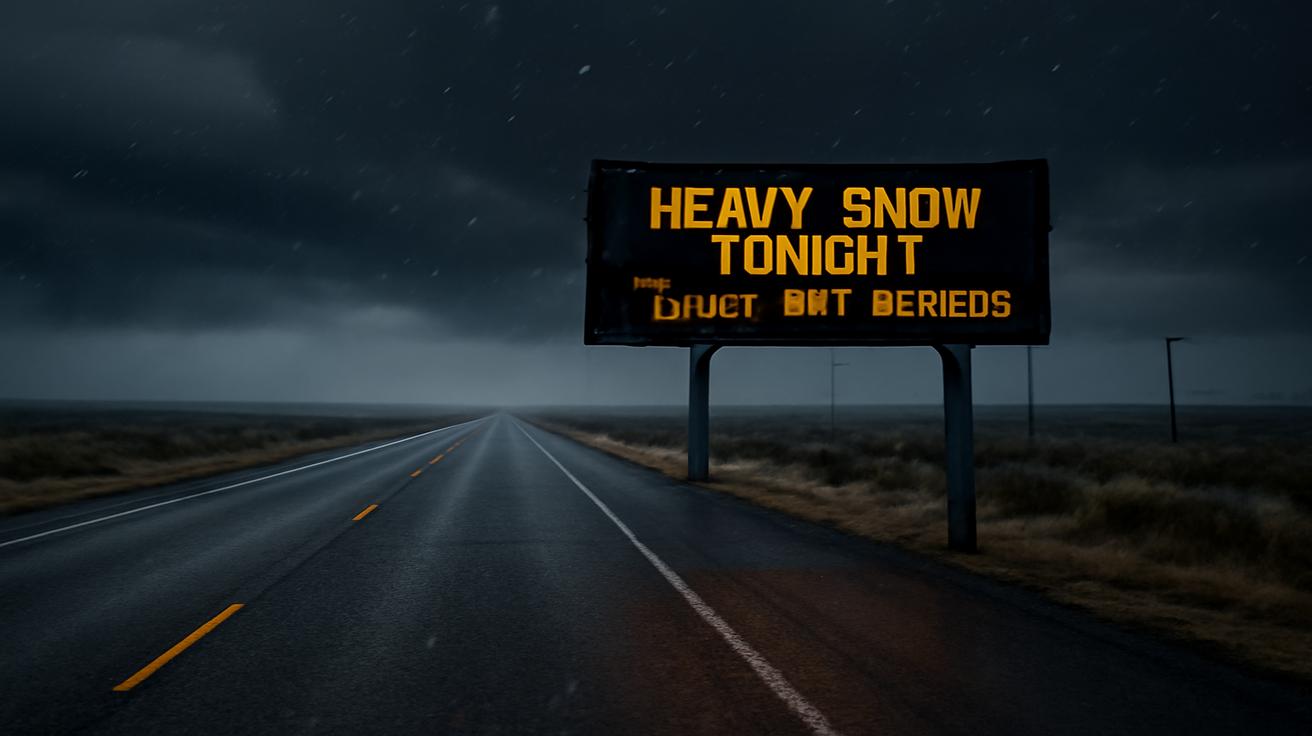
- Blizzards that combine heavy snow, violent winds, and whiteout conditions, making even short drives perilous.
- Repeated snow events stacking storm upon storm, leaving snowbanks higher than parked cars.
- Freeze–thaw whiplash that melts snow by day and refreezes it into black ice by night.
In the span of a few weeks, landscapes can transform. Rivers smoke with icy fog. City soundscapes turn muffled under snow, interrupted only by the crunch of tires and the distant whine of plows. Beneath that atmosphere lies a fragile web of infrastructure and routines suddenly under strain.
| Potential Impact | How It Shows Up | Why the Vortex Disruption Matters |
|---|---|---|
| Extended Cold Waves | Days or weeks of below-normal temperatures | Buckled jet stream allows Arctic air to linger farther south |
| Ice Storms | Freezing rain, glazed roads, power outages | Clashing air masses keep surface cold while warmer air rides above |
| Blizzards | Heavy snow, high winds, whiteout visibility | Slow-moving systems tap deep cold and moisture, fueled by altered storm tracks |
| Infrastructure Strain | Broken pipes, stressed grids, travel shutdowns | Intensity and persistence of cold exceed normal design limits |
Ice: The Silent Saboteur
If snow is winter’s showman, ice is its saboteur. It arrives quietly, often in the dark—raindrops that freeze on contact with pavement and branches, building a clear, glassy armor that looks beautiful and behaves like a weapon. During a strong polar vortex disruption, the pattern that sets up can make freezing rain more likely for some regions, especially where frigid surface air collides with a layer of warmer air higher up.
The experience is unsettling. One afternoon the world is wet and gray; by nightfall, each twig and wire is encased in crystal. Streetlights scatter through the glaze, and the entire neighborhood sparkles. Then, a subtle crack. A branch groans. A tree limb snaps with a gunshot pop, and the lights go out.
Ice storms don’t need to be epic to be dangerous. A few millimeters of glaze can turn a short walk into a risky slide. Hospital emergency rooms quietly fill with wrist fractures and head injuries. Power crews fan out in the dark, navigating blocked roads and downed lines, racing a clock measured in dropping indoor temperatures.
Blizzards: When the World Turns White
Not every polar vortex disruption leads to blizzards, but when the ingredients line up, they can be the defining image of a winter gone wild. Picture a brewing storm tapping moisture from a distant ocean or gulf, then running into a wall of Arctic air that’s been parked in place by the mangled jet stream.
Snow begins delicately, almost politely. Flakes drift past windows, catching streetlight halos. Within hours, the wind picks up. The snow thickens, turns less like flakes and more like a ceaseless white curtain, driven sideways and upward, finding every gap under doors and into eaves. Landmarks disappear. The world shrinks to the front porch, the car hood, the fence you can just barely see.
Inside, the soundscape shifts. The rush of traffic fades, replaced by a steady hiss and an occasional bass note of wind slamming against walls. Maintenance crews and emergency responders work on a different map now—one measured in passable routes, plowed corridors, and zones where visibility has collapsed.
In the wake of a disrupted polar vortex, these blizzards can come in waves. One storm, then another, then another, as the atmosphere locks into a storm-favoring pattern. Snow piles onto snow, drifting, shifting, forming sculpted ridges that outlast the calendar pages.
The Human Thread in a Turbulent Atmosphere
All of this might sound like something happening “out there,” in the realm of forecasts and satellite loops. But woven through every Arctic outbreak and ice storm is a human thread. The family layering blankets in a living room because the furnace failed under the strain. The road workers pushing through the night so nurses and grocery clerks can get to their shifts. The farmers watching their livestock huddle in fields transformed into frozen deserts.
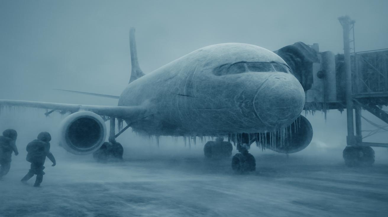
We’ve built our lives around a rough expectation of what each season will bring. When the polar vortex stumbles, those expectations are tested. Heating systems that were designed for a certain “normal” winter suddenly face temperatures ten or twenty degrees below that line for days at a time. Roads engineered for occasional snow become arenas for relentless freeze–thaw damage. Supply chains timed to the day are thrown into disarray by impassable highways and grounded planes.
Yet there’s another side to this story: how we adapt, improvising in the face of atmospheric mood swings. Neighborhoods sharing extension cords and hot meals. Cities opening warming centers. Farmers adjusting feed, shelter, and schedules in response to extended cold. Communities learning, slowly, how to read the clues that a season might not behave.
Reading the Signs: How Forecasters See It Coming
Long before the cold nips your fingers, there are whispers in the data. Meteorologists watch the high-latitude atmosphere with a kind of practiced suspicion, scanning for hints of an impending polar vortex disruption. Satellites and weather models trace the rise of energy from lower levels upward, the swelling warmth near the pole, the wobble in the vortex’s once-symmetric shape.
When those signs appear, the messaging begins carefully. Early on, it’s usually guarded: increased odds of colder conditions in certain regions, a tilt in the probabilities rather than a promise. That’s because the pathway from stratospheric disruption to surface weather is complex. The atmosphere is not a machine with a single on–off switch; it’s a restless, interlocking system.
Still, patterns emerge: regions that historically face increased risk of cold spells after major vortex disruptions, areas more prone to prolonged storminess, others that might actually turn milder. The timeline matters too. Sometimes the effects arrive within a week or two. Other times they unfold more slowly, like a shadow stretching across a map.
For those paying close attention, this advance warning is more than just trivia. It’s a chance to prepare—not in a panic, but in the quiet, practical ways that matter when the wind begins to howl and the mercury starts to fall.
Preparing for a Winter That Won’t Behave
So what does it mean, on the ground, to know that a significant polar vortex disruption is brewing? It’s not a call to stockpile in fear, but an invitation to be deliberate while there’s still time and calm.
- At home: Check seals on windows and doors; insulate exposed pipes; make sure you have backup light sources and a way to stay warm if the power goes out.
- On the road: Keep your vehicle’s fuel tank at least half full; carry a winter kit with blankets, gloves, water, and a charger; watch for rapidly changing conditions after storms.
- In your routine: Build in extra time and flexibility. Assume that some days, the safest choice will be to stay put.
- For health: Look out for vulnerable neighbors or family members—those who may struggle with heating bills, mobility, or medical needs during extended cold.
There is a kind of grounded calm that comes with understanding the forces at work. Instead of waking up shocked by an Arctic blast, you recognize it as one chapter in a larger atmospheric story that began weeks before, high above the pole.
Living with a Restless Winter
In a warming world, it can feel strange to talk about brutal cold and historic snow. Yet that’s part of the paradox. Climate change reshapes not just temperatures, but the very patterns that govern how air moves around the planet. While the details are still being vigorously studied, many scientists are probing whether a rapidly warming Arctic—where ice melts sooner and reforms later—could be linked to a more wobbly, disruption-prone polar vortex in some years.
What we do know is this: our weather is a product of contrasts. Warmth and cold, wet and dry, high and low pressure. When those contrasts sharpen or shift in unexpected ways, the extremes at the surface can become more dramatic. A disrupted polar vortex is one of the clearest, starkest examples of that.
Standing outside on a bitter evening, snow squeaking under your boots, it’s easy to feel like winter is an uncomplicated thing: cold air, frozen water, bare trees. But overhead, the atmosphere is a choreography of invisible currents and unseen boundaries. Right now, that choreography is changing, and with it, the rhythm of our winters.
So as this next disruption gathers strength high above the Arctic, it’s worth pausing between forecasts to really feel what it means. The sting on your cheeks is connected to a swirling ring of air thousands of miles away. The glint of ice on a power line traces back to a sudden warming in the stratosphere weeks earlier. Your small choices—where you park, what you stock, how you check on the people around you—are part of how we collectively navigate a season that’s becoming less predictable.
Winter has always been a test. This time, with a polar vortex stumbling and the atmosphere rearranging itself in real time, that test may come in the form of cascading hazards: ice that silences a city, blizzards that redraw familiar landscapes, cold that lingers past our patience. But within that challenge is also a nudge to pay closer attention, to see weather not as background noise but as an active, living system we are deeply entangled with.
The vortex is shifting. The jet stream is bending. The sky is, in its own way, rearranging the script. Our task now is to listen, prepare, and step into the coming days with eyes open—to the danger, yes, but also to the intricate, awe-inspiring machinery of the winter world above our heads.
Frequently Asked Questions
What exactly is the polar vortex?
The polar vortex is a large, persistent circulation of very cold air high in the atmosphere over the Arctic. When it’s strong and stable, it helps keep the coldest air locked near the pole. When it weakens or splits, that air can spill southward into North America, Europe, and Asia.
Does a polar vortex disruption always mean extreme cold where I live?
No. A disruption increases the odds of significant cold spells and storms in some regions, but the exact impacts depend on how the jet stream responds. Some areas may see intense cold, others may stay near normal, and a few could even turn milder.
How far in advance can forecasters see a disruption coming?
Meteorologists can often detect signs of potential disruption in the stratosphere one to three weeks in advance. However, translating that into precise local impacts is more challenging and becomes clearer only within about a week of major weather events.
Are polar vortex events becoming more common with climate change?
The relationship is still under active research. Some studies suggest that a warming Arctic may be linked to more frequent or intense disruptions in certain years, but the science is not fully settled. What is clear is that a warmer background climate can coexist with episodes of severe winter weather.
How can I best prepare for hazards like ice storms and blizzards?
Preparation starts with paying attention to forecasts and advisories. At home, insulate pipes, check heating systems, and keep basic supplies like food, water, flashlights, and blankets. For travel, carry winter emergency kits in your vehicle and be ready to adjust plans quickly if conditions deteriorate.


Leave a Comment