
The first sign is not the screaming headline, but the silence. You feel it before you read about it—an edge to the air, a stillness that presses against the windows. Somewhere far above, more than twice as high as the cruising altitude of a jetliner, the atmosphere is shifting. Invisible waves are punching into a tight ring of icy winds wrapped around the North Pole. And down here, where sidewalks glisten and breath hangs in the air, we’re waiting for something that doesn’t yet have a name: a level of cold so sharp it might force meteorologists to rethink what “extreme” even means.
The Sky Above the Weather
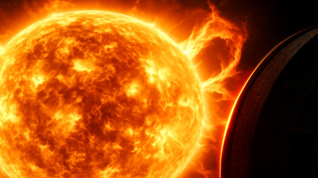
To understand what’s coming, you have to travel—at least in your imagination—into a part of the atmosphere most of us never think about. Meteorologists call it the stratosphere, a band of sky that begins roughly 10 to 12 miles above your head and stretches to about 30 miles. Up here, weather doesn’t look like what we see below. There are no familiar puffy clouds, no thunderstorms, no soft veils of rain. Instead there’s a cold, thin blue quiet, and in the winter hemisphere, a single giant feature dominates: the polar vortex.
Despite the sci‑fi flavor of its name, the polar vortex is simply a large, persistent cyclone of frigid air that forms every winter over the Arctic. Think of it as a vast atmospheric whirlpool, tens of miles deep and thousands of miles wide, spinning counterclockwise, locked in place by the contrast between the frozen North and the relatively warmer mid-latitudes. Along its southern edge, powerful west-to-east winds roar at more than 100 miles per hour, circling the pole like a planetary racetrack.
In a typical winter, this vortex stays mostly intact—cold air held in a tight, spinning bowl. The brutal heart of the Arctic winter remains largely corralled near the pole, while the rest of us get passing cold fronts, the occasional snowstorm, and the usual seasonal grumbling. But nothing about this year has been typical. High above Siberia and the North Atlantic, waves in the atmosphere—generated by mountains, land–sea contrasts, and vast storm systems—have been slamming into the vortex’s walls. With each hit, that once-solid bowl of cold begins to wobble.
Meteorologists have a phrase for what happens when that wobble becomes a crash: a “sudden stratospheric warming,” or SSW. The name sounds almost paradoxical. How can a burst of warming aloft lead to deeper cold at the surface? The answer lies in what the warmth disrupts.
When the Vortex Breaks
Imagine a spinning top. As long as it’s spinning fast and upright, it holds its shape, resisting outside nudges. This is the polar vortex in a stable winter: swift, cold, compact. But as the top slows or gets pushed, it begins to tilt, wobble, and sometimes split apart. In the atmosphere, sudden stratospheric warming acts like a shove to that spinning top.
Within just a few days, temperatures in the stratosphere above the Arctic can rocket upward by 30, 40, even 50 degrees Celsius. That doesn’t mean it becomes warm by human standards—it’s more like going from “unimaginably frigid” to “merely catastrophic for the vortex.” As this warming spreads, the once-dominant ring of winds weakens. Sometimes it collapses entirely; sometimes it splits into two or more smaller vortices that stagger southward like disoriented giants.
What unfolds afterward is less like a single event and more like a slow-motion atmospheric landslide. The disruption aloft works its way downward over days and weeks, reshaping the jet stream—that high-altitude river of winds that steers storms and separates frigid polar air from milder subtropical air. If the disruption is strong enough, the jet stream can buckle deeply, like a kinked hose. Arctic cold, once imprisoned, finds doorways flung open into North America, Europe, or East Asia.
The looming disruption—already brewing in the stratosphere as you read this—looks poised to be one of the big ones. Climate models and weather prediction systems are converging on a scenario where the polar vortex doesn’t just weaken; it undergoes a near-complete structural breakdown. The kind of breakdown that rearranges winter for entire continents.
A Different Breed of Cold
This isn’t simply another cold snap. Meteorologists are whispering, with the nervous excitement of people reading early seismograph needles before a quake, that the magnitude of the outbound cold could redefine what we call “extreme.”
We already have a language for it: wind chill warnings, hard-freeze watches, phrases like “dangerous cold” and “life-threatening wind chills.” But those categories were built around a particular distribution of winter weather—a bell curve in which the far edge, the 1‑in‑50 or 1‑in‑100 event, was rare enough to feel mythical when it arrived. A truly severe polar vortex disruption doesn’t just stretch the tail of that bell curve; it can yank it into a new shape entirely.
Meteorologists consider several factors when defining “extreme” cold events: how far temperatures drop below the seasonal norm, how many days they stay there, how large an area is affected, and how bitter the wind chill becomes. A city accustomed to winter lows around −5°C suddenly staring at −25°C is one kind of extreme. The same cold hanging on for ten straight days, under relentless wind, across a span from the Dakotas to New England—or from Scandinavia to the Balkans—is something else altogether.
In internal discussions, forecasters are already wrestling with numbers that don’t fit comfortably into the old boxes. Model simulations hint at temperatures plunging 15 to 25 degrees Celsius below average for vast regions, with wind chills carving those numbers down even further. Not everywhere, and not all at once—but enough, and for long enough, that the word “extreme” starts to feel inadequate, like calling a hurricane “breezy.”
Cold You Can Feel in the Story of Others
To grasp what this might mean in human terms, it helps to revisit winters that left scars. In January 1985, a massive Arctic outbreak crashed into the eastern United States after a major polar vortex disturbance. Orange trees in Florida blackened under ice. Pipes burst from Georgia to Maine. The morning news unfolded like a ledger of failures: power grids, car batteries, heating systems, all blinking out in the teeth of a wind that seemed to cut through bricks and bone.
Or think back to the “Beast from the East” in Europe in 2018, born from a powerful sudden stratospheric warming event. A lobe of the disrupted vortex drifted over the continent, unleashing Siberian air that turned familiar streets into wind-sculpted corridors of snow. Commuters trudged past frozen fountains. The rail network shuddered under snowdrifts and broken lines. In Britain, a country where “a bit of snow” is usually shorthand for inconvenience, the cold was deadly.
During the North American outbreak of January 2019—a polar vortex event many still remember—the city of Chicago felt like a living stress test. The air temperature fell to −30°C, with wind chills below −45°C. Train tracks were literally set on fire to keep steel from shrinking and seizing. The sound of the city changed: less car noise, more the metallic groan of expanding and contracting structures, the crunch of boots on snow so dry it squeaked.
Now imagine a disruption that rivals or exceeds those episodes in its intensity, but potentially over a broader canvas and in a world with more people, more infrastructure, and more interconnected systems than ever. A world where supply chains are already taut, energy grids are increasingly complex, and many cities are built not around the question, “What if it gets this cold?” but, “How often will it?”
What “Redefining Extreme” Really Looks Like
To call an event “extreme” is to admit it lies outside our collective experience. To say we may need new classifications is to confess something more unsettling: that the climate we designed our systems around may no longer be a reliable guide.
Here’s one way to think about it. Traditional “extreme cold” thresholds in meteorology are often tied to return periods—an event so severe you’d expect to see it, statistically, only once in 30 years or once in 50. But those probabilities are pegged to the past. When the stratosphere misbehaves in particularly violent ways, you can get compound extremes: cold interacting with wind, with prolonged darkness, with snowpack and ice, with stressed infrastructure. The result is not just a colder day, but a different category of risk.
Below is a simple comparison to visualize the difference between an ordinary cold snap and the kind of outbreak a severe polar vortex disruption can unleash:
| Feature | Typical Winter Cold Snap | Severe Polar Vortex Disruption Event |
|---|---|---|
| Temperature anomaly | 5–10°C below average | 15–25°C below average |
| Duration | 2–4 days | 7–14+ days |
| Geographic scale | Regional (a few states or countries) | Continental or hemispheric reach |
| Wind chill | Occasional dangerous values at night | Persistent, life-threatening values day and night |
| Infrastructure stress | Localized power and transport issues | Widespread grid strain, transport paralysis, burst pipes |
In the context of the coming disruption, “redefining extreme” means we may see cold outbreaks that sit off the chart of what local plans and engineering standards considered likely. A city whose heating network was sized for a “once in 50 years” event might suddenly find itself staring down a “once in 200 years” scenario—except those probabilities are shifting so fast that looking in the rearview mirror no longer tells you what’s around the next bend.
Living with a Broken Compass
There is, of course, a deeper and more troubling question that follows: is this just bad luck in the chaos of the atmosphere, or a sign of a climate system evolving into new patterns? The honest answer is that it’s partly both, and scientists are still untangling the threads.
The polar vortex is sensitive to many things: snow cover in Siberia, sea-ice extent in the Arctic, the behavior of the North Atlantic Ocean, even distant tropical thunderstorms. As the planet warms, these players are changing. Arctic sea ice is thinner and more fractured. Ocean temperatures are climbing. Snow cover patterns are shifting. All of this alters the atmospheric waves that can either leave the vortex mostly alone—or slam into it like a sledgehammer.
Some studies suggest that reduced sea ice and a warmer Arctic can increase the odds of polar vortex disruptions by changing the way heat and momentum move between the surface and the stratosphere. Others argue that the relationship is more subtle, and that the vortex might actually strengthen in some climate scenarios. What’s clear, though, is that our reference frame is moving. We are trying to read a compass whose needle is slowly drifting.
At the same time, human vulnerability to these extremes is not static. More people live in cities dependent on aging infrastructure. Supply chains zigzag across continents, vulnerable to a single chokepoint—a frozen rail yard, a major port brought to a standstill by blizzard conditions. Our homes, offices, and hospitals depend on just-in-time delivery of fuel and power, in a season where any interruption can turn deadly within hours.
What You Can Do Before the Air Bites
For all the talk of stratospheric dynamics and jet stream meanders, the question that matters most is simple: what does this mean at your front door? The answer is less about panic and more about timing. Sudden stratospheric warming events typically occur one to three weeks before their full effects are felt at the surface. That lag is a gift—a small window where anticipation can become preparation.
In the coming days, as meteorological agencies refine their forecasts, you may hear phrases like “major pattern change,” “Arctic outbreak,” or “prolonged cold spell.” If you live in a region along the mid-latitude storm tracks—from the northern United States to much of Europe and parts of Asia—that’s your cue not only to watch, but to act.
Check the basics: Is your home insulated well enough to hold heat if the power flickers? Do you know how to turn off water at the main valve if a pipe bursts? Are your car’s fluids and battery prepared for temperatures well below what you consider “normal winter”? If you rely on medications that must be kept at certain temperatures, do you have a way to store them safely in case heating fails?
None of this is glamorous. It’s not the dramatic satellite loops of spiraling storms or color-splashed maps of temperature anomalies. It’s the quiet work of becoming less fragile in a season where the air itself can be hostile. In a sense, personal readiness is the mirror image of atmospheric disruption: one is a breakdown of stability aloft, the other an attempt to build stability on the ground.
Cold as a Teacher
There is an old, unhurried wisdom in winter. Before we had bulging reservoirs of data and satellites watching every pixel of cloud, cold snaps were explained with stories: the north wind angry, a gate left open in the ice, spirits wandering from the pole. We’ve traded those tales for terms like “polar vortex disruption” and “temperature anomalies,” but the lesson is the same. The world is not built to our measures. It periodically reminds us of that, sometimes with a ferocity that leaves no room for misinterpretation.
When the coming disruption peaks, and the jet stream buckles, and the Arctic air spills forward, it will not care that our power plants are old, that our budgets for insulation were cut, that the categories we use—“severe,” “historic,” “record-breaking”—were written for a different baseline. It will simply arrive: in the way your eyelashes freeze together on a short walk, in the way your nostrils sting at the first breath outside, in the creak of trees rigid with ice.
And yet, there is also something clarifying in these episodes. They reveal where systems are brittle and where communities are resilient. They expose which buildings trap heat efficiently and which leak it like a sieve. They show us, brutally but honestly, whether our definitions of “extreme” were wishes or reality-based maps.
In the long run, meteorologists will look back on this event with charts and datasets, recalibrating what “extreme cold” means in a warming world. Perhaps new categories will emerge, new thresholds, new color bands on the weather maps. But on the day the air changes where you live, you won’t experience it as a category. You’ll experience it as a sound, a silence, a sting in your fingers, a decision about whether to step outside or stay home.
The polar vortex is shifting. The sky above the weather is rewriting its script. As that story filters down through the layers of atmosphere and finally reaches your street, the question won’t just be how cold it can get, but what we choose to learn from the edge it brings.
FAQ
What exactly is a polar vortex disruption?
A polar vortex disruption occurs when powerful atmospheric waves weaken, displace, or split the ring of strong winds that usually trap cold air over the Arctic. This often begins with a sudden warming in the stratosphere (a sudden stratospheric warming event), which then gradually affects the jet stream and surface weather, allowing Arctic air to spill southward.
Does a polar vortex disruption always mean extreme cold where I live?
No. A disruption increases the odds of severe cold in some mid-latitude regions, but not everywhere. The exact pattern depends on how the jet stream responds—some areas may get brutal cold, others may stay near normal, and some may even turn milder than average.
How far in advance can meteorologists predict these events?
Signs of a polar vortex disruption in the stratosphere can often be detected one to three weeks in advance. However, translating that signal into precise surface impacts—where the cold will hit hardest and when—typically becomes reliable only within about 5–10 days of the event.
Is climate change making polar vortex disruptions more common?
The scientific community is still debating this. Some research suggests that a warming Arctic and changing sea-ice patterns may increase the likelihood or intensity of disruptions, while other studies find a weaker connection. What is clear is that as the climate baseline shifts, the impacts of these disruptions on people and infrastructure can become more severe.
How can I prepare for an extreme cold outbreak linked to a vortex disruption?
Preparation focuses on warmth, power, and water. Insulate your home as well as possible, service heating systems, and protect exposed pipes. Keep extra blankets, warm clothing, and non-perishable food on hand. Ensure your vehicle is winter-ready, and make a plan for vulnerable family members or neighbors who may need help if the cold is prolonged or power is lost.


Leave a Comment